

Trade networks in the ancient world linked civilizations across continents through extensive maritime routes. You’ll see how ports and cities acted as bustling hubs for exchanging goods, ideas, and innovations. These routes helped spread technology, religious beliefs, art, and languages, creating vibrant cultural exchanges. They also supported growing urban centers and advanced navigation techniques. If you explore further, you’ll discover how these interconnected routes shaped the foundations of our modern global society.
Key Takeaways
- Maritime routes facilitated cultural, religious, and technological exchanges among distant civilizations.
- Trade centers and ports acted as hubs for commerce and cultural interactions across regions.
- Innovations in shipbuilding and navigation spread, enabling longer and more efficient voyages.
- Infrastructure like ports and caravanserais supported sustained trade and exploration activities.
- Trade networks interconnected economies and cultures, fostering global interconnectedness in the ancient world.
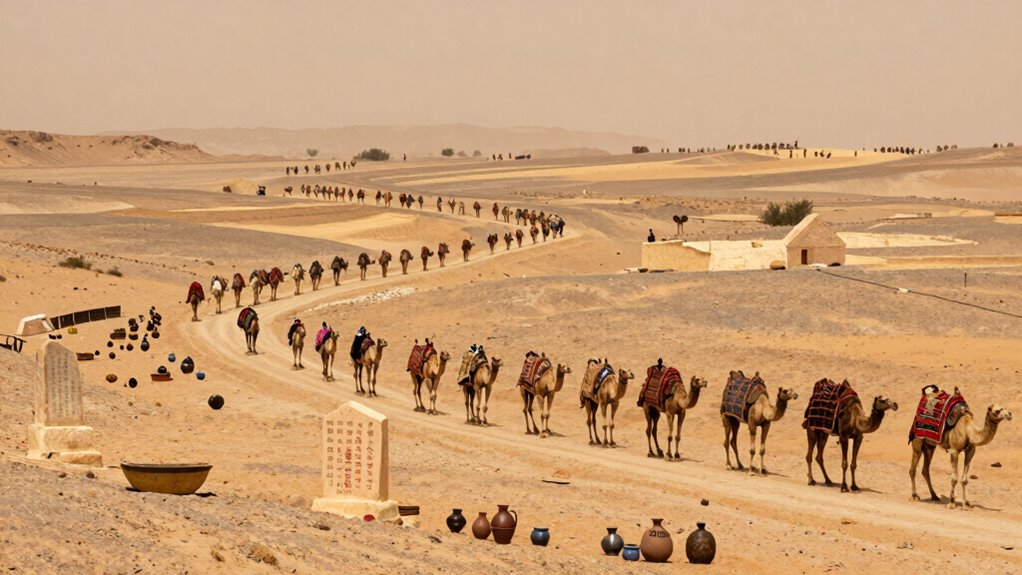
Maritime routes enabled civilizations that were geographically separated to interact regularly, making it easier to share innovations, religious beliefs, art, and even language. When ships docked at ports, they brought more than goods—they carried ideas, stories, and customs that mingled with local traditions. This process of cultural exchanges helped societies grow more diverse and sophisticated, enriching their art, architecture, and social practices. For instance, traders from the Middle East and Asia exchanged not only goods but also philosophies and religious beliefs, such as Buddhism spreading along trade routes into Central Asia and beyond.
You’ll see that these trade routes also encouraged the development of complex networks of cities and ports, each serving as hubs of commerce and cultural interaction. These centers became melting pots where different peoples, languages, and traditions converged. As you imagine traveling along these routes, you might picture bustling markets and vibrant port cities teeming with merchants from various lands, exchanging stories and goods amid a lively atmosphere. These interactions created a web of connections that extended across continents, linking Africa, Asia, Europe, and the Indian Ocean in a web of interconnected societies. Additionally, the exchange of technological innovations along these routes contributed to significant advancements in various fields and industries. Furthermore, the sharing of navigation methods played a crucial role in expanding the reach of maritime trade, allowing explorers to venture further with greater confidence. The dissemination of scientific knowledge such as astronomy and mathematics also helped improve navigation techniques and fostered a spirit of exploration. Moreover, the development of trade infrastructure like ports and caravanserais facilitated smoother and more secure exchanges across long distances.
The impact of these trade networks went far beyond the simple exchange of commodities. They helped spread innovations in technology, such as shipbuilding techniques and navigational tools, which in turn improved trade efficiency. The flow of ideas along maritime routes also facilitated scientific knowledge, like astronomy and mathematics, which further boosted trade and exploration. In this way, the ancient world’s trade networks didn’t just connect economies—they interconnected cultures and civilizations, laying the groundwork for the global exchanges that continue today. You can see that understanding these routes reveals how interconnected human history truly is, emphasizing the importance of maritime routes and cultural exchanges in shaping the world you live in. Additionally, these trade routes were instrumental in the dissemination of cultural ideas, impacting societies far beyond their original regions.
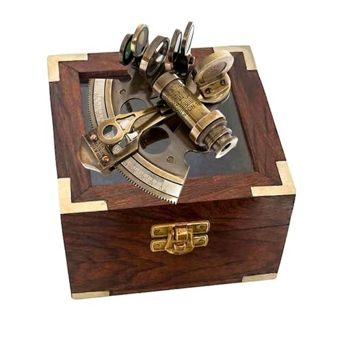
Nautical Bronze Sextant – Solid Brass Maritime Astrolabe | Vintage Ship Navigation Instrument for Nautical Decor, Collectibles, Maritime Gifts, and Navigational Tools
SIZE AND PACKAGING: This sextant is portable and easy to carry anywhere. Its size is 3.5"wide, 4.0" long…
As an affiliate, we earn on qualifying purchases.
As an affiliate, we earn on qualifying purchases.
Frequently Asked Questions
How Did Trade Routes Evolve Over Different Historical Periods?
Trade routes evolved markedly over time through trade route innovations and merchant community development. You’d see early routes expand with new technologies like the compass and better ships, making distant trade possible. As merchant communities grew, they created safer, more organized networks, encouraging more trade. These innovations and community efforts transformed trade routes from simple paths into complex, interconnected systems that linked distant parts of the world, fostering cultural exchange and economic growth.
What Role Did Geography Play in Shaping Ancient Trade Networks?
Geography shaped ancient trade networks by dictating routes like maritime navigation and desert crossings. You’d find that coastlines and seas facilitated sea-based trade, making maritime navigation essential, while vast deserts forced traders to develop routes like the Silk Road to cross challenging terrain. Mountains, rivers, and deserts all influenced where traders traveled, creating specific pathways that connected distant civilizations and promoted cultural and economic exchanges.
How Did Trade Influence Cultural Exchanges Between Civilizations?
Trade sparks cultural exchanges, blending diverse traditions and ideas. You see this in cultural diffusion, where civilizations adopt each other’s beliefs, customs, and technologies. Artistic influences flow between societies, inspiring new styles and techniques. While commerce connects economies, it also creates a vibrant exchange of culture, turning distant peoples into shared communities. This interconnectedness deepens your understanding of history, showing how trade shaped not just goods but the very fabric of human creativity.
What Were the Main Challenges Faced by Traders in Ancient Times?
You face many challenges as an ancient trader. Maritime obstacles like storms, pirates, and dangerous currents threaten your journey across seas. On land, you deal with difficult terrains and bandits. Currency systems can be unreliable, causing disputes over trade values. Charting these obstacles requires skill, courage, and trust in local systems. Despite these hardships, trade persists, fueling connections and cultural exchanges across vast regions.
How Did Ancient Trade Networks Impact Modern Global Commerce?
Ancient trade networks, like the Silk Road and maritime routes, laid the groundwork for modern global commerce by establishing interconnected markets and cultural exchanges. They introduced ideas, goods, and technologies across vast distances, creating a foundation for international trade systems. Today, these routes influence shipping, diplomacy, and economic policies, shaping how you access goods worldwide. Their legacy fosters international cooperation and competition, driving economic growth and innovation in the global marketplace.
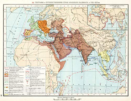
Arab Caliphate 8th–13th Centuries Route Map – 1959 Historical Atlas Print – 24in x 18in
Historical map reproduction showing geography and trade routes of the Arab Caliphate during the 8th–13th centuries at 1:50,000,000…
As an affiliate, we earn on qualifying purchases.
As an affiliate, we earn on qualifying purchases.
Conclusion
You can see how trade networks acted like the veins of the ancient world, carrying life and culture across vast distances. They connected distant civilizations, turning isolated communities into a vibrant, interconnected web. Just as rivers shape landscapes, these routes shaped history, blending ideas and goods into a rich tapestry. Recognize that, even today, the echoes of those ancient pathways remind us how interconnected our world truly is—each trade route a thread in the fabric of human history.

The Ship Model Builder's Assistant
As an affiliate, we earn on qualifying purchases.
As an affiliate, we earn on qualifying purchases.

Port Royal Sound 1977 Nautical Chart – Historical Map Print – 24in x 30in
1977 nautical chart of Port Royal Sound, South Carolina, sourced from NOAA historical records.
As an affiliate, we earn on qualifying purchases.
As an affiliate, we earn on qualifying purchases.