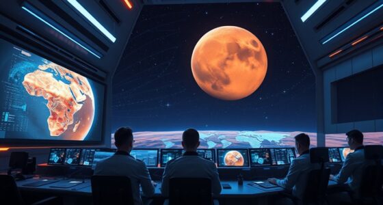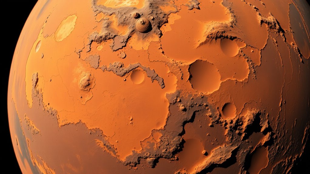

A detailed map of Mars made from over 100,000 images gives you an incredible view of the planet’s surface. It highlights diverse terrains like ancient river valleys, volcanic plains, and deep canyons. This map helps scientists analyze surface features, study erosion, and identify mineral deposits. It also improves rover navigation by showing hazards and safe paths. Keep exploring to discover how this map is transforming Mars exploration and what secrets it might reveal next.
Key Takeaways
- The map offers a highly detailed view of Mars’ surface, constructed from over 100,000 images.
- It highlights diverse terrain features like valleys, volcanoes, craters, and canyons for comprehensive surface analysis.
- High-resolution imagery enhances surface detail, aiding scientific research and geological understanding.
- The map improves rover navigation safety by identifying hazards and optimal routes across varied terrain.
- It supports future exploration by providing precise topographical data and surface feature insights.
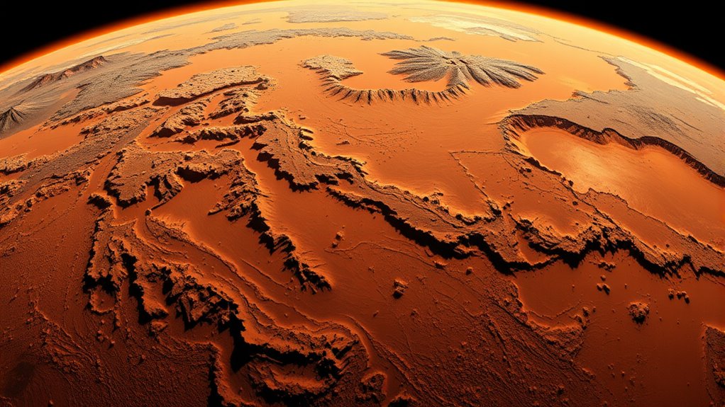
Scientists have revealed a highly detailed global map of Mars, providing new insights into the planet’s surface features. This map, created from over 100,000 images, offers an all-encompassing view of the Martian landscape like never before. As you explore this map, you’ll notice the intricate variety of mars terrain, from ancient river valleys and vast volcanic plains to towering crater rims and deep canyon systems. The detailed imagery allows you to see features that were previously difficult to distinguish, giving you a clearer picture of the planet’s geological history and surface composition. This extensive mapping effort also incorporates high-resolution imagery, greatly enhancing our understanding of surface details at a scale relevant for scientific analysis. This extensive mapping effort considerably enhances rover navigation across Mars. With such detailed visuals, mission planners can plot safer, more efficient routes for rovers like Perseverance and Curiosity. You’ll find that the map highlights potential hazards, such as loose rocks, steep slopes, or unstable ground, which are critical for safe traversal. When directing a rover, understanding the terrain is essential—you can avoid areas that may jeopardize the mission or cause delays, ensuring that scientific instruments reach their targets smoothly. The high-resolution imagery also helps scientists and engineers analyze specific surface features in greater detail. You can identify mineral deposits, locate ancient water channels, and study erosion patterns, all of which are important for understanding Mars’ past habitability. For rover navigation, this means better planning of scientific experiments and movement strategies. You’ll be able to identify promising sites for sampling or drilling, saving valuable time and resources during missions. Furthermore, this map enables a more precise assessment of the planet’s topography. Elevation differences, slope steepness, and surface roughness are now clearly mapped, allowing you to anticipate how rovers might encounter different terrains. This knowledge helps in designing navigation algorithms that adapt to varying conditions, reducing the risk of getting stuck or tipping over. It also supports future landing site selection by revealing areas with ideal terrain for landing and mobility. Additionally, understanding the detailed surface features can aid in the development of advanced navigation systems, which are crucial for future exploration missions. Incorporating terrain variability into these systems ensures more accurate and reliable rover movement across diverse Martian landscapes. Moreover, ongoing advancements in mapping technology further improve the precision and utility of such detailed surface representations. Enhanced 3D modeling and surface analysis techniques continue to refine our understanding of Martian topography, leading to safer and more successful missions.

24×36 gallery poster, Map of Mars
MUSEUM QUALITY: Printed on museum-quality photo paper: Our product is printed on satin-finish photo paper that is typically…
As an affiliate, we earn on qualifying purchases.
As an affiliate, we earn on qualifying purchases.
Frequently Asked Questions
How Long Did It Take to Compile the Global Map?
You might wonder how long it took to compile the global map. It actually took several months, depending on the data accuracy and the advanced mapping technology used. By processing over 100,000 images, scientists could guarantee precise detail. Your understanding of this process highlights how modern mapping technology accelerates exploration, allowing us to piece together the Red Planet’s surface efficiently and accurately, revealing new insights about Mars.
What New Features Are Visible on the Map?
You can now see new features on the map, giving you a clearer view of Mars’ surface and geological features. With detailed imagery, you’ll notice craters, valleys, and volcanic formations that were previously hard to identify. These features help you understand Mars’ geological history better. The map’s high resolution allows you to explore subtle surface variations and geological formations, making Mars’ landscape more accessible and fascinating for your exploration and study.
Can the Map Help Identify Future Landing Sites?
Sure, this detailed map might seem like just pretty pictures, but it actually helps with landing site selection and rover navigation. Ironically, the more we see, the more complex choosing the perfect spot becomes. You can use this map to identify safer, scientifically valuable sites, making future missions smarter. So yes, it’s a treasure trove for planning precise landings and ensuring rovers can explore efficiently without getting lost.
How Does This Map Compare to Previous Mars Maps?
You’ll notice this map offers much higher resolution compared to previous Mars maps, allowing for more detailed surface features. It also considerably improves historical accuracy by integrating over 100,000 images, creating a clearer, more precise representation of the planet. This advancement helps scientists and explorers better understand Mars, making it a valuable tool for future missions. Overall, it surpasses older maps in both clarity and reliability.
Will the Map Be Available for Public Access?
Imagine opening a treasure chest of knowledge—that’s what your access to this map feels like. Yes, it will be available for public access, transforming data sharing into a shared adventure. You’ll be able to explore the Red Planet’s secrets firsthand, joining scientists and enthusiasts alike in revealing Mars’s mysteries. This open access invites everyone to step into the story, making the universe a little closer for you.

Remote Sensing Image Classification and Semantic Segmentation
As an affiliate, we earn on qualifying purchases.
As an affiliate, we earn on qualifying purchases.
Conclusion
This incredible map shows you just how detailed our view of Mars has become, making you wonder if future missions could uncover even more secrets. As scientists continue to piece together these images, it’s clear that technology is revealing the red planet’s mysteries faster than ever. Maybe, one day, this level of detail will lead to humans setting foot there. For now, this map proves that our curiosity about Mars is only growing stronger.
Mars rover navigation tools
As an affiliate, we earn on qualifying purchases.
As an affiliate, we earn on qualifying purchases.
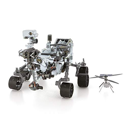
Fascinations Metal Earth Mars Rover Perseverance & Ingenuity Helicopter 3D Metal Model Kit
HOBBY MODEL KIT – Unassembled model packed in an envelope with easy to follow instructions. Ideal for ages…
As an affiliate, we earn on qualifying purchases.
As an affiliate, we earn on qualifying purchases.